

Quick answer
The Pico do Fogo trail is a 6-kilometer round-trip route gaining 1,100 meters elevation from Chã das Caldeiras to the 2,829-meter summit. The ascent typically takes three to four hours, with descent requiring two to three hours due to loose scoria and ash. The trail is unmarked in sections, and volcanic terrain shifts after eruptions, making a guide strongly recommended for first-time visitors.
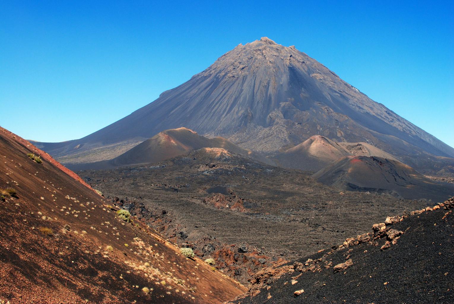
Pico do Fogo last erupted in 2014, reshaping the caldera floor and leaving fresh lava fields that hikers cross before reaching the base of the cone. The summit crater emits sulfur vents year-round, and surface temperatures near fumaroles can exceed 90°C even when air temperatures hover near freezing. The pico do fogo trail begins in Chã das Caldeiras at approximately 1,700 meters elevation. The first kilometer crosses relatively flat volcanic ash plains before the gradient steepens sharply. The upper two-thirds of the ascent follows a loose scoria slope where every step forward slides half a step back, demanding sustained effort and proper footwear. Hikers without ankle support frequently turn back due to instability in the black sand. The final 200 meters to the rim are the steepest, often requiring hands-on scrambling over larger volcanic rocks. Wind speeds at the summit regularly exceed 40 kilometers per hour, and visibility can drop to near zero when clouds descend over the caldera. The volcano hike is accessible throughout the year, though conditions vary significantly by season. December through March brings cooler temperatures and occasional rain, which compacts the ash and improves footing but can obscure the route in fog. April through November offers clearer skies and predictable weather, but midday heat on the exposed slope becomes punishing without early starts. Local guides from Chã das Caldeiras know current trail conditions, recent rockfall zones, and the safest descent routes, which shift as erosion and minor seismic activity alter the cone's profile. Independent hikers have become disoriented on the descent when following GPS tracks that no longer match the terrain. The summit rewards the effort with views across the entire Fogo Island, neighboring Brava Island, and Santiago Island on clear days. The crater itself is approximately 500 meters in diameter, with the inner walls dropping nearly vertically into a sulfur-stained abyss. Most guided groups spend 20 to 30 minutes at the top before beginning the descent, which tests knees and ankles as the scree accelerates every step into a controlled slide.
“The upper two-thirds of the ascent follows a loose scoria slope where every step forward slides half a step back, demanding sustained effort and proper footwear.”
Best Time to Hike the Pico do Fogo Trail
The best arrival window for the Pico do Fogo trail is between 05:00 and 07:00. Starting during these hours is necessary to avoid midday heat and ensure completion before afternoon temperatures peak.
November to March
ModerateCooler temperatures, 15-22°C, ideal for climbing. Higher visibility levels.,,
April to June
LowIncreasing warmth, 20-26°C. Clear skies common for ascent.,,
July to October
HighHot temperatures, 24-30°C. High heat risk requires early starts.,,
Early morning departures
Low—,Safe temperatures and better mountain visibility.
Verdict: For the safest and most comfortable hike, aim for an arrival between 05:00 and 07:00 during the cooler months of November through March.
Step-by-Step Guide for the Pico do Fogo Trail
The Pico do Fogo trail climbs from Chã das Caldeiras through volcanic ash slopes to the 2,829-meter summit, then descends the same route. The round trip takes 4–6 hours depending on pace and conditions.
Start from Chã das Caldeiras village
Begin at the trailhead on the northern edge of the settlement. Many hikers miss the correct path in the dark—look for the stone cairn marking the start.
Ascend the ash slope
Climb the steep scree field in a zigzag pattern to maintain traction. The loose volcanic ash makes every step slide back; short strides and a steady rhythm work better than lunging upward.
Navigate the ridge to the crater rim
Follow the ridge as the trail narrows and the grade eases. The path is clear in daylight but easy to lose in mist—stay on the ridgeline rather than drifting toward the crater's inner edge.
Reach the summit marker
Arrive at the concrete marker at 2,829 meters. Spend only 10–15 minutes at the top if wind or temperature is severe; the exposed summit offers no shelter.
Descend via the ascent route
Return down the ash slope using a controlled sliding technique. Lean back slightly and let gravity carry you—resisting the slide wastes energy and increases knee strain.
Entrance Fees for the Pico do Fogo Trail
Access to the Pico do Fogo trail within the park is free of charge. Optional guided tours are available for those who prefer professional assistance.
A typical adult pays 0 EUR for park entry, with costs only occurring if you choose to hire a local guide.
Getting to the Pico do Fogo Trail
The Pico do Fogo trail begins within the Chã das Caldeiras, a volcanic caldera located on the island of Fogo in Cape Verde. Accessing this remote starting point requires traveling to the island by air or sea before navigating the local mountain roads.
Aluguer (shared taxi) from São Filipe to Chã das Caldeiras
Rental vehicle via local mountain roads to Chã das Caldeiras
Walking from local guesthouses within Chã das Caldeiras to the trailhead
Opening Hours of the Pico do Fogo Trail Park
The Pico do Fogo trail is accessible daily throughout the year. Visitors may enter the park at any time during the week.
| Monday | 00:00–23:59 | |
|---|---|---|
| Tuesday | 00:00–23:59 | |
| Wednesday | 00:00–23:59 | |
| Thursday | 00:00–23:59 | |
| Friday | 00:00–23:59 | |
| Saturday | 00:00–23:59 | |
| Sunday | 00:00–23:59 |
Pico do Fogo Trail Preparation Checklist
Prepare for a technical volcanic ascent requiring proper footwear, sun protection, and sufficient water capacity.
-
Wear sturdy hiking boots with ankle support — The trail crosses sharp volcanic rock and loose scree that demands stable footwear.
-
Carry 3+ liters of water per person — No water sources exist on the exposed ascent in temperatures exceeding 30°C.
-
Pack sun protection and a hat — The trail offers zero shade from the summit crater to Chã das Caldeiras.
-
Bring layers for temperature variation — Summit conditions can be 15°C cooler than the base with strong winds.
-
Confirm guide availability if booking one — Many hikers hire local guides from Chã das Caldeiras for route-finding and safety.
-
Download offline maps of the route — Mobile coverage is unreliable on the volcano slopes.
Check availability
Frequently asked questions about the pico do fogo trail
Everything you need to know about pico do fogo trail