

Quick answer
The Pico do Fogo volcano hike covers approximately 8 kilometers round-trip with 1,000 meters of elevation gain, typically requiring 4 to 6 hours total (2.5–3 hours ascent, 1.5–2 hours descent). Guided tours are mandatory for the climb. The trail crosses loose volcanic scoria that shifts underfoot, demanding trekking poles and ankle-supporting boots. Early morning starts between 05:00 and 07:00 avoid midday heat and afternoon cloud cover that can obscure summit views.
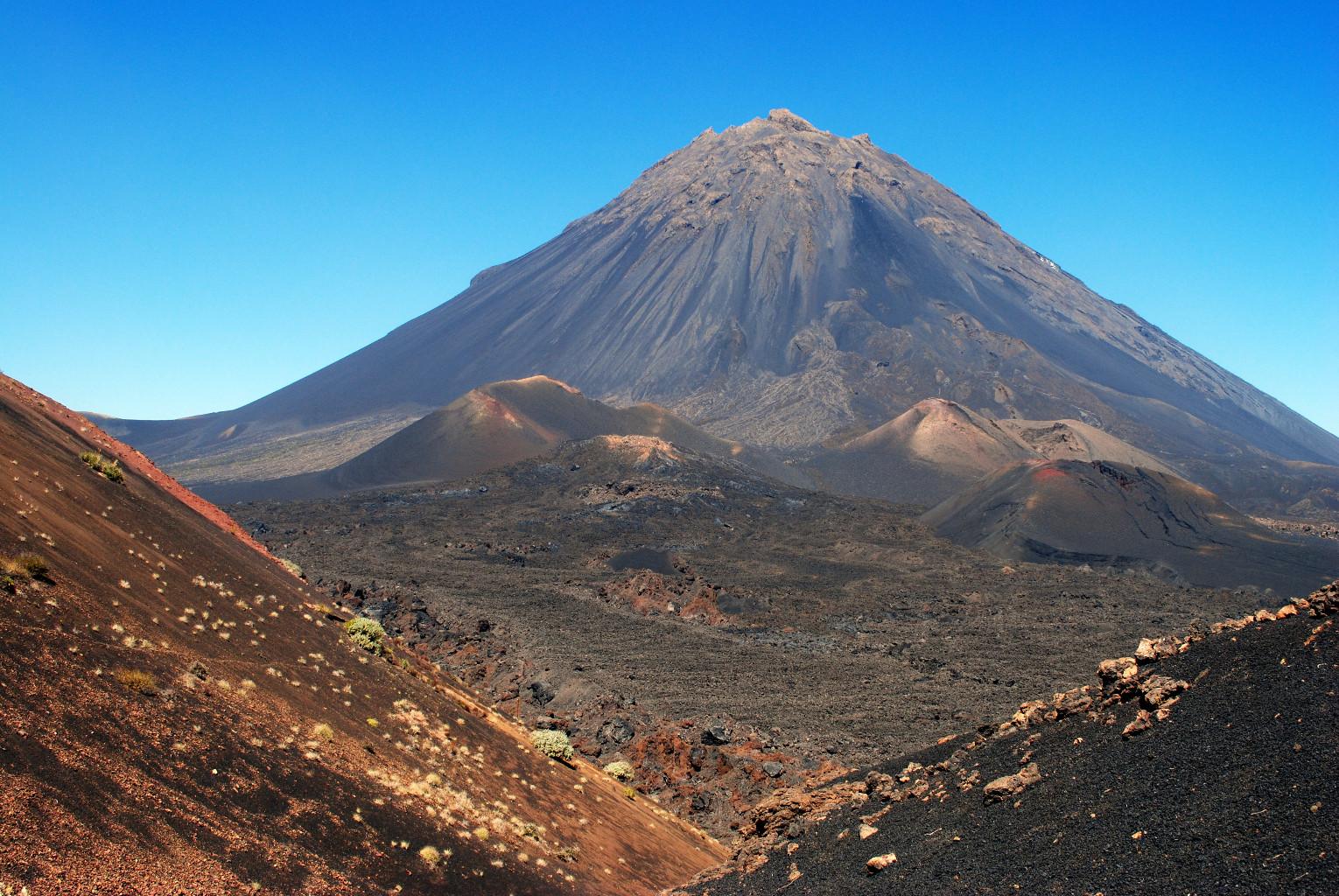
Pico do Fogo last erupted in 2014, sending lava flows through Chã das Caldeiras and burying two villages beneath solidified basalt. The caldera floor, where most guided ascents begin, sits at roughly 1,800 meters elevation—already higher than any peak in continental Portugal. What remains is a cone of black scoria rising another thousand vertical meters, steep enough that the final approach requires scrambling over loose volcanic rock that slides backward with each step. The ascent route follows the volcano's southern flank, where the gradient averages 35 degrees but steepens near the summit crater. No switchbacks exist. Hikers climb straight up the fall line, using trekking poles to stabilize on shifting gravel. The scoria absorbs heat quickly; by mid-morning, surface temperatures can exceed 40°C, turning the climb into an endurance test against sun exposure and dehydration. Most guided groups depart Chã das Caldeiras between 05:00 and 06:00 to reach the crater rim by 08:30, when visibility remains clear and temperatures tolerable. The summit crater measures 500 meters in diameter, with sulfur vents releasing steam along the eastern edge. Views extend across the entire Fogo Island caldera, over the Atlantic to neighboring Santiago Island on clear days, and down into the crater itself where fumaroles mark the volcano's persistent geothermal activity. The descent retraces the ascent route but proves faster—many hikers glissade down the scoria slopes in controlled slides, cutting descent time to under 90 minutes. Physical conditioning matters more than technical skill. The altitude, heat, and uneven footing combine to test cardiovascular stamina and leg strength. Hikers accustomed to sea-level trails often underestimate the exertion required at 2,800 meters. Adequate hydration—at least three liters per person—and sun protection separate prepared climbers from those who turn back halfway. The trail offers no shade, no water sources, and no bailout routes once you commit to the ascent.
“The scoria absorbs heat quickly; by mid-morning, surface temperatures can exceed 40°C, turning the climb into an endurance test against sun exposure and dehydration.”
Pico Do Fogo Volcano Hike Admission and Guide Requirements
Access to the natural park area of Pico do Fogo is provided at no cost. While entry to the park is free, hikers are required to hire professional guides for the summit ascent.
Hikers pay 0 EUR for park entry, but must budget for mandatory professional guide services which vary by local operator.
How to Reach the Pico Do Fogo Volcano Hike Start Point
The Pico do Fogo volcano hike begins in Chã das Caldeiras, located in the interior of Fogo Island, Cabo Verde. Reaching this remote area requires traveling from São Filipe, the island's main town.
São Filipe to Chã das Caldeiras
Aluguer (shared taxi) from São Filipe to Chã das Caldeiras
Rental vehicle via Estrada de Chã
Typical Pico Do Fogo Volcano Hike Itinerary
This plan suits hikers with good fitness tackling the 2,829-metre summit in a single day. Expect 6–8 hours round-trip, including the ascent, crater rim exploration, and the scree-field descent.
Depart Chã das Caldeiras
Start from the village base with your guide, crossing black lava fields as the sun rises. The initial slope is gradual, warming up your legs for the steeper sections ahead.
Steep volcanic cone ascent
The path turns sharply upward on loose scoria and ash; use trekking poles for stability. Progress slows, and the air thins noticeably as you gain elevation.
Summit and crater rim
Reach the caldera edge for unobstructed views into the active crater and across the island. Spend 20–30 minutes here; wind can be strong, so layer accordingly.
Descend via ash scree
Drop through deep volcanic ash on the southern flank, a fast but leg-intensive descent. Gaiters keep debris out of your boots.
Return to Chã das Caldeiras
Arrive back at the trailhead, dusty and tired. Most guided groups include a post-hike coffee or local lunch in the village.
Pico Do Fogo Volcano Hike Preparation Checklist
The volcanic terrain and high-altitude exposure demand specific gear and early preparation.
-
Book a guided tour in advance — Ascent requires an authorized guide; operators arrange permits and logistics.
-
Break in sturdy hiking boots — Loose volcanic scoria and steep slopes demand ankle support and grip.
-
Pack 2–3 liters of water per person — No water sources exist on the trail; dehydration risk is high in exposed conditions.
-
Bring sun protection and a wide-brimmed hat — Minimal shade and intense UV exposure above 2,800 meters require full coverage.
-
Wear layers for temperature swings — Summit can be 15°C cooler than the base; wind chill adds to the drop.
-
Carry high-energy snacks — The 4–6 hour climb requires sustained effort; quick fuel prevents energy crashes.
-
Charge your phone and camera fully — No charging points exist in Chã das Caldeiras or on the trail.
Pico Do Fogo Volcano Hike Opening Hours
The Pico do Fogo natural park area is accessible throughout the day and night. While the terrain is technically open 24 hours, practical access for the ascent is governed by local guide availability and safety conditions.
| Monday | 00:00–23:59 | |
|---|---|---|
| Tuesday | 00:00–23:59 | |
| Wednesday | 00:00–23:59 | |
| Thursday | 00:00–23:59 | |
| Friday | 00:00–23:59 | |
| Saturday | 00:00–23:59 | |
| Sunday | 00:00–23:59 |
Check availability
Frequently Asked Questions About Pico do Fogo Volcano Hike
Everything you need to know about pico do fogo volcano hike