

Quick answer
Pico do Fogo trekking follows a 4-6 hour round-trip route from Chã das Caldeiras village at 1,600 meters to the 2,829-meter summit crater, crossing steep scoria slopes with 1,200 meters of elevation gain. The main trail ascends the western flank through loose volcanic ash and basalt fields, requiring early morning departure between 06:00-09:00 to avoid midday heat and afternoon cloud cover that obscures visibility and increases descent risks on the unstable scree.
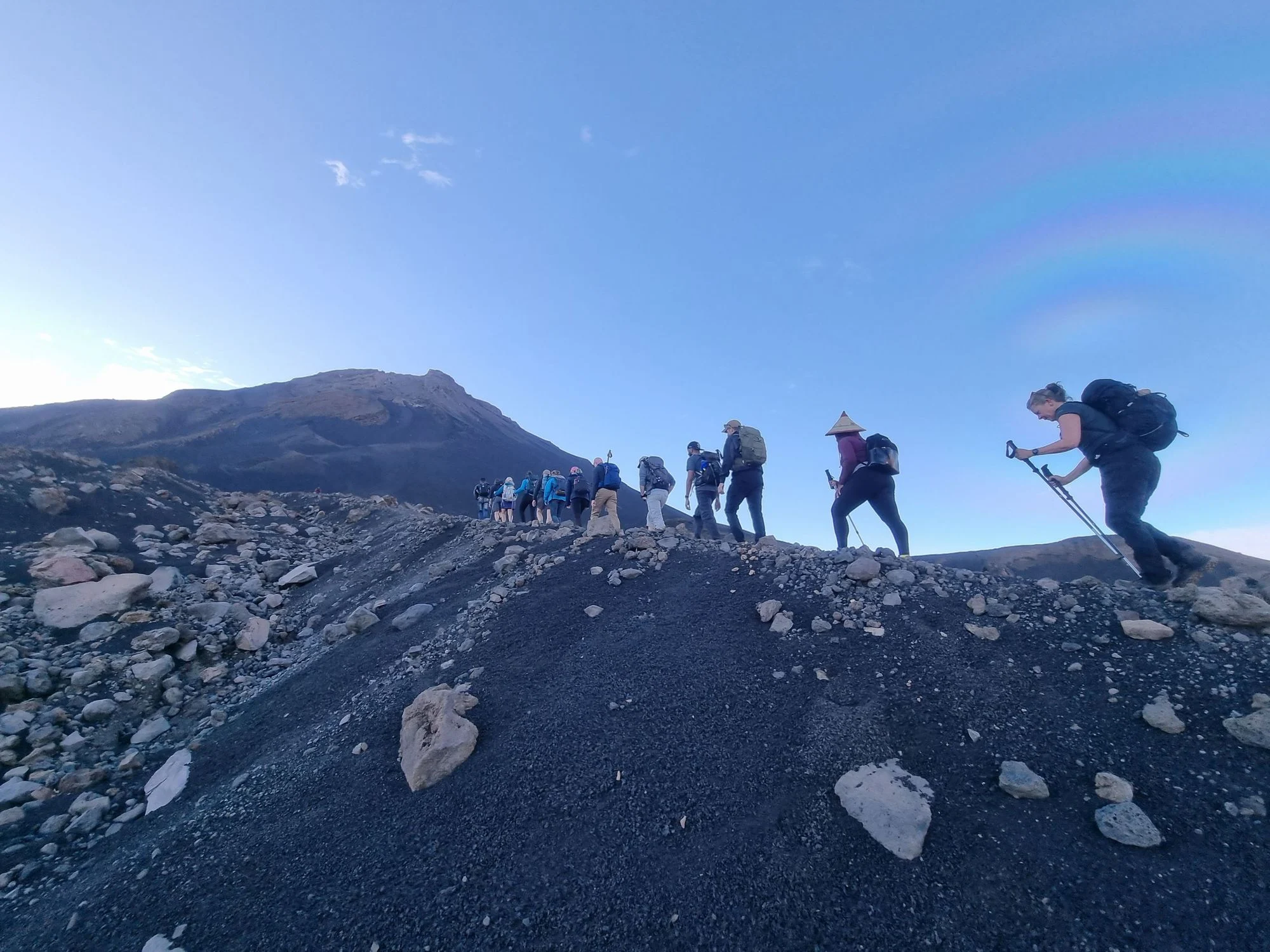
The Pico do Fogo summit trail begins where the 2014 lava flow stopped at the edge of Chã das Caldeiras, a collapsed caldera that serves as base camp for the ascent. Trekkers start from the village at 1,600 meters elevation and climb directly up the western cone face, a relentless gradient of black and red volcanic scoria that shifts underfoot with every step. The path is unmarked for most of its length—navigation relies on following the ridgeline and the boot tracks of previous climbers etched into the ash. The terrain demands constant attention. The lower third crosses hardened lava tongues from recent eruptions, jagged basalt that requires careful footing. Above 2,200 meters the slope steepens to 35-40 degrees and the surface becomes pure scoria, loose cinder that slides backward with each stride and turns the final 600 meters into a grinding test of endurance. Wind accelerates as the ridgeline narrows, and exposed sections offer no shelter from the gusts that sweep across the caldera. The summit crater reveals itself in stages—first the sulfur-stained fumaroles venting steam, then the sheer drop into the 180-meter-deep central pit where the 2014 eruption originated. Guides are not mandatory but are standard practice; local knowledge prevents route errors on the featureless upper slopes and provides context for the volcanic features underfoot. The descent follows the same route and takes 2-3 hours, a controlled slide down the scoria channels that punishes knees and ankles. Clouds roll in from the Atlantic by mid-afternoon, reducing visibility to meters and making navigation difficult without GPS or a guide familiar with the terrain. The caldera itself offers alternative routes for trekkers who want volcanic landscapes without the summit grind. The Bordeira trail circles the inner caldera rim, passing wine terraces and the ruins of villages buried by the 2014 flow. The volcanic cone of Pico Pequeno, a smaller parasitic crater at 1,900 meters, provides a half-day trek with similar geology but gentler gradients. Both options keep hikers within the Fogo Natural Park boundaries, where the 2 EUR conservation fee applies regardless of route choice. Physical conditioning matters more than technical skill. The ascent is non-technical—no scrambling or exposure requiring ropes—but the altitude, heat and scoria slog exhaust unprepared trekkers. Acclimatization helps; spending a night in Chã das Caldeiras before the climb reduces altitude strain. Water requirements are higher than most mountain treks due to the exposed volcanic terrain and lack of shade—3 liters minimum per person is the local recommendation, not a suggestion.
“The final 600 meters turn into a grinding test of endurance where loose cinder slides backward with each stride.”
Pico do Fogo Trekking Opening Hours
The Pico do Fogo trekking area is accessible every day of the week. Visitors may enter the park at any time.
| Monday | 00:00–23:59 | |
|---|---|---|
| Tuesday | 00:00–23:59 | |
| Wednesday | 00:00–23:59 | |
| Thursday | 00:00–23:59 | |
| Friday | 00:00–23:59 | |
| Saturday | 00:00–23:59 | |
| Sunday | 00:00–23:59 |
Getting to the Start of Your Pico do Fogo Trekking Experience
The trekking route begins in Chã das Caldeiras, located within the caldera of Fogo, Cape Verde. Visitors typically reach this area from the island's main hub, São Filipe.
São Filipe to Chã das Caldeiras via circular road
Aluguer (shared taxi) from São Filipe to Chã das Caldeiras
Rental vehicle via local road network to Chã das Caldeiras
Essential Checklist for Pico do Fogo Trekking
Prepare for steep volcanic terrain, rapid weather shifts, and no facilities on the mountain.
-
Sturdy hiking boots with ankle support — Loose volcanic scoria demands grip and stability on steep slopes.
-
Sun protection and hat — Intense equatorial UV exposure above 2000 m with little shade.
-
2–3 liters of water per person — No water sources exist on the trail; dehydration risk is high.
-
Windproof jacket and layers — Summit temperatures drop sharply and winds pick up unexpectedly.
-
Small cash for the park fee — Bring exact change for the 2 EUR conservation fee collected at trailheads.
-
Trekking poles (optional but recommended) — Descending loose scoria is easier and safer with poles for balance.
Check availability
Frequently asked questions about pico do fogo trekking
Everything you need to know about pico do fogo trekking